‘Communications Blackout At 1.30pm, Crash At 2.20 pm’: Why Badrinath-Dehradun Chopper Route Remains Dangerous
Six people were killed as a helicopter on the way from Badrinath to Dehradun crashed near Joshimath on Friday afternoon, Uttarakhand disaster management officials said. The district administration further said that the h
Ni Manjiri Joshi··114K nabasa
‘Communications Blackout At 1.30pm, Crash At 2.20 pm’: Why Badrinath-Dehradun Chopper Route Remains Dangerous
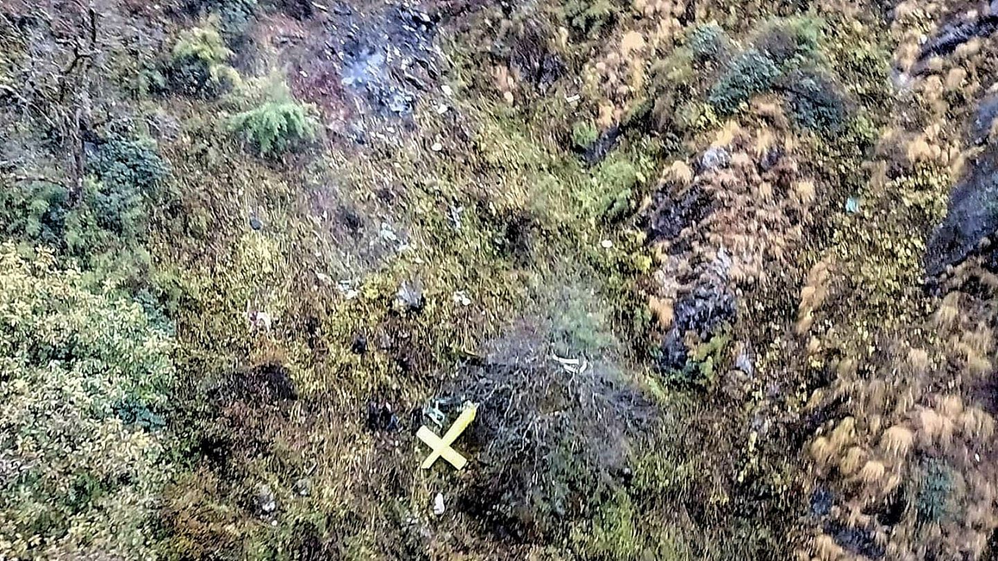
Six people were killed as a helicopter on the way from Badrinath to Dehradun crashed near Joshimath on Friday afternoon, Uttarakhand disaster management officials said. The district administration further said that the helicopter that belonged to ‘Trans Bharat Aviation’ crashed into a hillside near the JP Power House.
What actually happened and how dangerous was the route?
TIMELINE OF THE ACCIDENT
1:14 PM – Takeoff: The private civilian helicopter (call sign VT-HCX) took off from the Badrinath helipad, carrying a pilot and five passengers from Bengaluru, Karnataka. It was scheduled to fly the routine mountain corridor back down to the Sahastradhara heliport in Dehradun.
Around 1:30 PM – Communications Blackout: While navigating the highly volatile Joshimath valley, the helicopter completely dropped off the grid. Both its tracking systems stopped transmitting and all radio communications with air traffic control were instantly lost.
Around 2:20 PM – The Crash: Local residents near the valley reported hearing a loud, concussive sound and sighting thick smoke rising near Chai village. The helicopter had crashed directly into a hillside near the JP Power House, situated just behind the Hathi Parvat region.
Contributing Environmental Factors
The Uttarakhand Civil Aviation Development Authority (UCADA) noted that the flight originally received clearance based on favourable local weather conditions at takeoff. However, the microclimate in the Joshimath valley shifted violently minutes later. The aircraft flew directly into dense cloud cover, heavy localized rain, and sudden high-altitude snowfall, which completely blinded the pilot’s visual route navigation (VFR).
THE OP
Following an urgent mobilization ordered by Chief Minister Pushkar Singh Dhami, search teams from the Indian Army, SDRF, ITBP, and local police launched a rescue mission. Teams located the physical wreckage on a steep slope above an Army camp. All six individuals on board were killed upon impact. The victims were later identified as:
Captain Himanshu Sabharwal (The pilot, from Delhi)
Arun Salunke (A police inspector with the Bengaluru Crime Branch)
Prathap Bichihalli, Shankar Gowda VB, Sudhir K, and H. S. Nagaraja (Passengers from Bengaluru)
As an immediate safety measure following the recovery, the Directorate General of Civil Aviation (DGCA) and UCADA grounded the entire operational fleet of Trans Bharat Aviation pending a strict, comprehensive safety investigation.
HOW DANGEROUS IS THE ROUTE?
Flying the Badrinath to Sahastradhara (Dehradun) helicopter route involves navigating severe terrain and volatile weather, making it one of the most risk-prone aviation sectors in India. The safety of this route is heavily impacted by the extreme environment of the Char Dham pilgrimage circuit.
Official data from the Aircraft Accident Investigation Bureau (AAIB) highlights that the Char Dham aviation sector averaged at least one accident or serious incident every single year from 2022 onwards.
RISK FACTORS
Microclimates and Rapid Weather Shifts: The route moves from the high-altitude Alaknanda valley down to the foothills of Dehradun. Weather in these Himalayan passes changes within minutes, bringing unexpected snowfall, heavy monsoon cloud build-up, and sudden blinding fog that traps aircraft inside narrow gorges.
Visual Flight Rules (VFR) Limitations: Choppers on this route operate strictly under VFR, meaning pilots must physically see the terrain to navigate. When visibility falls below safety thresholds, pilots face extreme difficulty navigating the narrow valleys safely.
Unforgiving High-Altitude Terrain: Flights take off from the Badrinath Helipad at over 10,300 feet and travel down to the Sahastradhara Heliport at roughly 2,800 feet. The massive elevation changes require pilots to cross highly turbulent zones, including the notoriously treacherous Hathi Parvat and Joshimath valley areas.
Air Density and Mechanical Strain: High altitudes feature thin air and low atmospheric pressure, which significantly degrades helicopter rotor lift and engine performance. This makes critical maneuvers—especially takeoffs and emergency landings—substantially more difficult.
SAFETY MEASURES
In response to frequent accidents, the Uttarakhand Civil Aviation Development Authority (UCADA) and the Directorate General of Civil Aviation (DGCA) strictly enforce standard operating procedures. Operators found flying in marginal conditions face mandatory grounding of their entire fleet while investigations take place.
Pilgrims choosing this route are strongly advised to plan their journeys during clear weather windows (typically May–June and September–October), verify the safety track record of their chosen aviation provider, and be prepared for mandatory flight cancellations if the mountain weather turns volatile.