Weather
Wind signals lifted as Maymay moves east of Central Luzon
Tropical Cyclone Wind Signals were lifted as Tropical Depression Maymay moves over the sea east of Central Luzon while maintaining its strength, according to weather bureau PAGASA.
8K reads
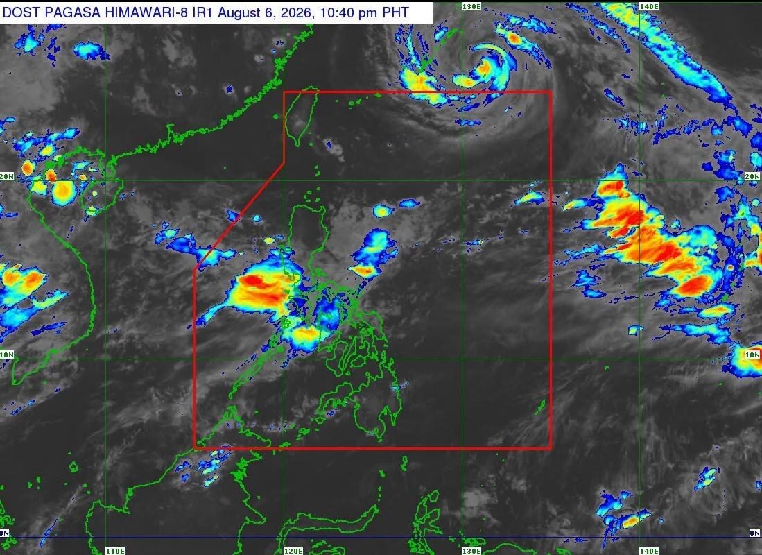
Tropical Cyclone Wind Signals were lifted as Tropical Depression Maymay moves over the sea east of Central Luzon while maintaining its strength, according to weather bureau PAGASA.
In its 11 p.m. tropical cyclone bulletin on Thursday, it said parts of the country will still experience rains due to Maymay and the Southwest Monsoon.
The center of Maymay was estimated at 290 km east of Casiguran, Aurora, moving east southeastward at 35 kilometers per hour with maximum sustained winds of 45 km/h and gustiness of up to 55 km/h.
On the latest forecast track, PAGASA said Maymay is forecast to continue weakening and may be downgraded into a remnant low on Friday morning.
The remnant low of Maymay will move generally eastward until it merges into the larger circulation of Tropical Cyclone Dolphin.
Rainfall outlook
PAGASA also issued a rainfall outlook due to Maymay and the Southwest Monsoon:
Heavy rainfall outlook due to Maymay
August 6 to August 7
(50-100 mm): Ilocos Sur, La Union, Pangasinan, and Benguet
August 6 to August 7
(50-100 mm): Ilocos Sur, La Union, Pangasinan, and Benguet
Heavy rainfall outlook due to Southwest Monsoon
August 6 to August 7
Heavy to Intense (100-200 mm): Occidental Mindoro
Moderate to Heavy (50-100 mm): Zambales, Bataan, Tarlac, Pampanga, Bulacan, Metro Manila, Rizal, Cavite, Laguna, and Batangas
August 6 to August 7
Heavy to Intense (100-200 mm): Occidental Mindoro
Moderate to Heavy (50-100 mm): Zambales, Bataan, Tarlac, Pampanga, Bulacan, Metro Manila, Rizal, Cavite, Laguna, and Batangas
August 7 evening to August 8
Heavy to Intense (100-200 mm): Zambales, Bataan, and Occidental Mindoro
Moderate to Heavy (50-100 mm): Ilocos Sur, La Union, Pangasinan, Abra, Benguet, Tarlac, Pampanga, Metro Manila, Cavite, Batangas, and Antique
Heavy to Intense (100-200 mm): Zambales, Bataan, and Occidental Mindoro
Moderate to Heavy (50-100 mm): Ilocos Sur, La Union, Pangasinan, Abra, Benguet, Tarlac, Pampanga, Metro Manila, Cavite, Batangas, and Antique
August 8 evening to August 9
Heavy to Intense (100-200 mm): Ilocos Sur, La Union, Abra, Benguet, and Zambales
Moderate to Heavy (50-100 mm): Ilocos Norte, Pangasinan, Apayao, Kalinga, Mountain Province, Ifugao, Nueva Vizcaya, Tarlac, Nueva Ecija, Bataan, Pampanga, and Occidental Mindoro —LDF GMA News
Heavy to Intense (100-200 mm): Ilocos Sur, La Union, Abra, Benguet, and Zambales
Moderate to Heavy (50-100 mm): Ilocos Norte, Pangasinan, Apayao, Kalinga, Mountain Province, Ifugao, Nueva Vizcaya, Tarlac, Nueva Ecija, Bataan, Pampanga, and Occidental Mindoro —LDF GMA News
Share