Weather
Maymay crosses Northern Luzon; 4 areas remain under Signal No. 2
Tropical Storm Maymay began crossing Northern Luzon after making landfall over Magsingal, Ilocos Sur, PAGASA said in its 5 a.m. Thursday bulletin.
8K reads
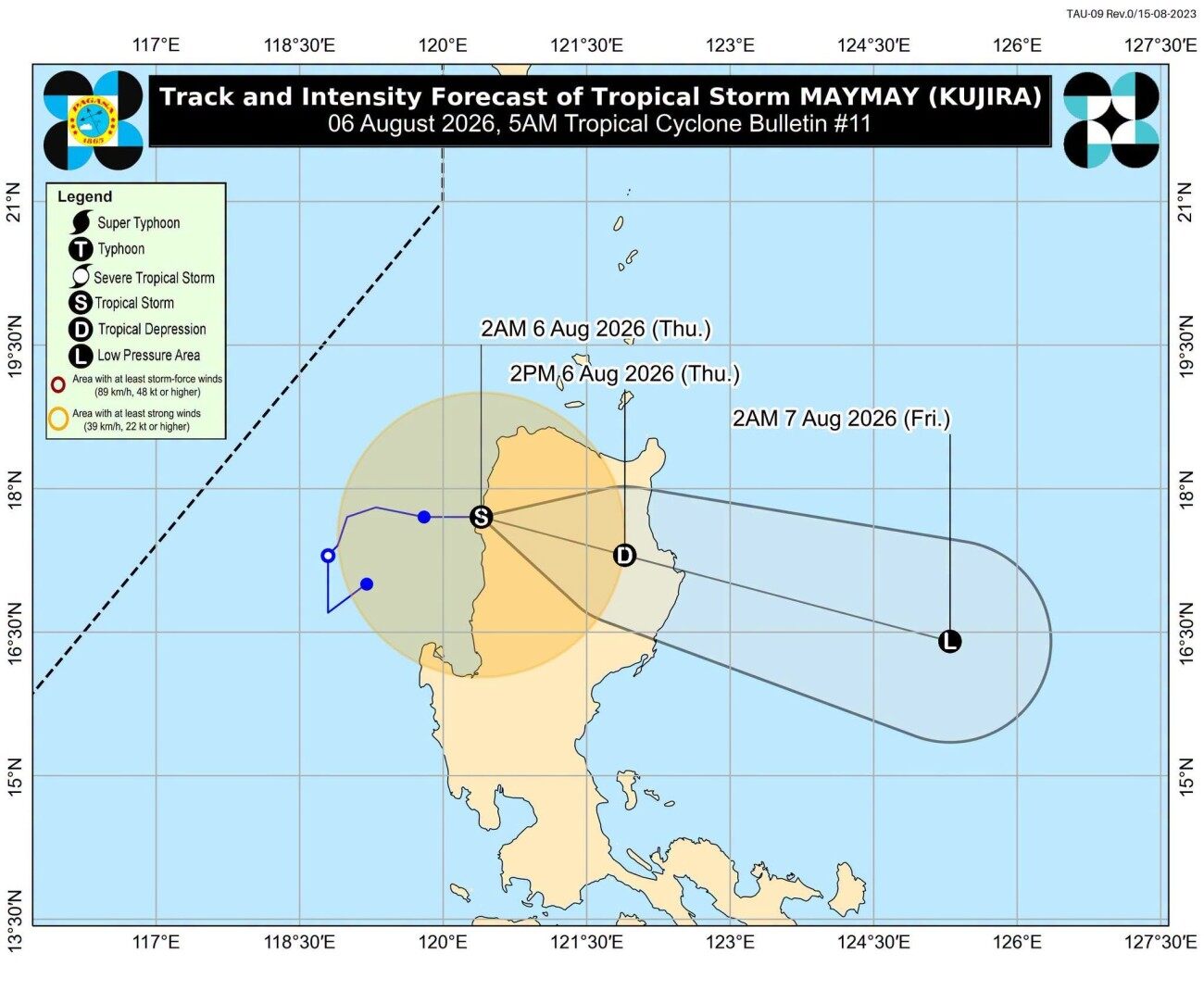
Tropical Storm Maymay began crossing Northern Luzon after making landfall over Magsingal, Ilocos Sur, PAGASA said in its 5 a.m. Thursday bulletin.
Moving eastward at 10 km/h, Maymay was located in the vicinity of San Juan, Ilocos Sur as of 4 a.m.
The storm's maximum sustained winds slightly weakened to 65 km/h near the center, with gusts of up to 110 km/h.
Under Tropical Cyclone Wind Signal No. 2 are:
Signal No. 1 was hoisted over:
Maymay will traverse the mountainous terrain of Northern and Central Luzon before emerging over the eastern coastal waters of Isabela or Cagayan, PAGASA said, adding that the storm is expected to continue weakening as it moves farther inland.
"It will weaken into a tropical depression likely this morning and may be downgraded into a remnant low this afternoon or evening. However, due to interaction with the rugged terrain, an earlier weakening is possible," PAGASA said.
"The remnant low of Maymay will move generally southeastward until it merges into the larger circulation of tropical cyclone Dolphin." —VBL GMA News
Share