Weather
LPA outside PAR develops into tropical depression
The low pressure area (LPA) being monitored by PAGASA outside the Philippine Area of Responsibility (PAR) developed into a tropical depression on Saturday morning.
5K reads
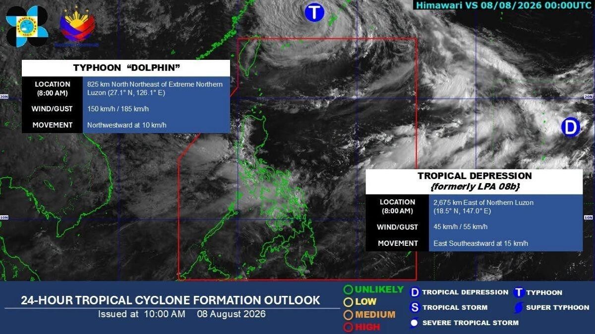
The low pressure area (LPA) being monitored by PAGASA outside the Philippine Area of Responsibility (PAR) developed into a tropical depression on Saturday morning.
The tropical depression formerly identified as LPA 08b was located at 8 a.m. at 2,675 km east of Northern Luzon.
It is packing winds of 45 km/h with gustiness of 55 km/h.
The tropical depression is moving east southeastward at 15 km/h.
DOST-PAGASA weather specialist Veronica C. Torres during the bureau's public weather forecast earlier on Saturday said this weather disturbance has a low chance of directly affecting the country and a low chance of entering PAR.
Meanwhile, Typhoon Dolphin which is also outside PAR was estimated to be located at 825 km north northeast of Extreme Northern Luzon at 8 a.m., PAGASA said.
Dolphin has maximum winds of 150 km/h with gustiness of 185 km/h.
The typhoon is moving northwestward at 10 km/h.
"Itong bagyong ito ay mababa ang tsansang pumasok sa Philippine Area of Responsibility at magkaroon ng direktang epekta sa kahit anong parte ng ating bansa," Torres said.
(This typhoon has a low chance of entering PAR and have a direct effect on any part of the country.)
However, Typhoon Dolphin continues to enhance the Southwest Monsoon (Habagat) which is affecting Luzon and Visayas, she added.
Luzon and the Visayas will experience rains within the next 24 hours due to the Southwest Monsoon (Habagat), PAGASA said Saturday morning.
Monsoon rains will affect Occidental Mindoro, Zambales, and Bataan, while Metro Manila, Ilocos Region, Abra, Benguet, Tarlac, Pampanga, Bulacan, Rizal, Cavite, Laguna, Batangas, Oriental Mindoro, and Antique will experience occasional rains. —KG GMA News
Share