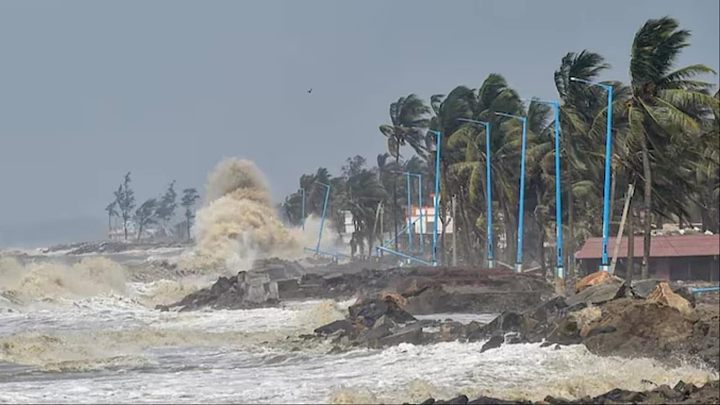
Cyclone Akwan: Odisha Begins Evacuation, Tamil Nadu Braces For Very Heavy Rains As IMD Warns Of Severe Storm
A deep depression over the Bay of Bengal is likely to intensify into Cyclone Akwan on Monday, November 16, and further strengthen into a severe cyclonic storm by Tuesday, according to the India Meteorological Department
By Vani Mehrotra··43K reads
Cyclone Akwan: Odisha Begins Evacuation, Tamil Nadu Braces For Very Heavy Rains As IMD Warns Of Severe Storm
A deep depression over the Bay of Bengal is likely to intensify into Cyclone Akwan on Monday, November 16, and further strengthen into a severe cyclonic storm by Tuesday, according to the India Meteorological Department (IMD). The weather system is expected to move northwestwards towards the Andhra Pradesh coast and could reach the region around the night of November 19 as a very severe cyclonic storm.
With the system gathering strength, Odisha has begun preparations for a possible third cyclone in three weeks, directing district administrations, particularly in the southern and coastal regions, to remain on alert.
Authorities have also been asked to initiate early evacuation of people living in vulnerable locations.
Meanwhile, the Chennai Meteorological Department has forecast heavy to very heavy rainfall in Chennai and neighbouring districts of Tamil Nadu over the coming days, with November 18 and 19 emerging as the main period of concern.
The approaching system has triggered precautionary measures across the eastern and southern coastal regions, with authorities preparing for rainfall, strong winds and rough sea conditions.
CYCLONE AKWAN: HOW THE SYSTEM IS DEVELOPING
According to the IMD’s latest bulletin, the weather system originated as a well-marked low-pressure area over the southeast Bay of Bengal before intensifying into a depression at 5.30 am on November 15.
The depression subsequently moved north-northwestwards and continued to gain strength over the southeast and adjoining southwest Bay of Bengal.
In its November 15 bulletin, the IMD said the system was centred near latitude 9.0°N and longitude 86.9°E.
It was located approximately 700 km west-southwest of Sri Vijaya Puram (Port Blair) in the Andaman Islands, 860 km east-southeast of Chennai, 1,040 km south-southeast of Visakhapatnam and 1,160 km south-southeast of Gopalpur in Odisha.
The weather department had initially forecast that the depression would intensify into a cyclonic storm over the central parts of the south and adjoining west-central Bay of Bengal on November 16, followed by further strengthening into a severe cyclonic storm over the west-central Bay of Bengal on November 17.
The IMD’s subsequent forecast indicated that the system had moved north-northwestwards at a speed of 8 kmph over the preceding six hours.
It was centred on Monday morning approximately 680 km from Sri Vijaya Puram, 720 km from Chennai, 820 km from Visakhapatnam and 940 km from Gopalpur.
The IMD said, “Thereafter, it is likely to intensify further and move northwestwards and reach over west-central Bay of Bengal near Andhra Pradesh coast around the night of November 19, 2026, as a very severe cyclonic storm.”
ODISHA BEGINS EARLY EVACUATION, IDENTIFIES VULNERABLE AREAS
The Odisha government has directed district administrations in the southern region to begin early evacuation of people from vulnerable areas as the approaching weather system intensifies.
According to news agency PTI, officials have been asked to identify locations that could be affected by heavy rainfall and move residents to safer places before the onset of adverse weather conditions.
Ganjam Collector Keerthi Vasan V was quoted as saying that the district administration had identified landslide-prone locations and low-lying areas that could face inundation during the cyclone.
“There are hilly areas and low-lying places across Ganjam district. Men and machinery are ready to begin shifting people well before the rains,” Vasan told reporters.
He said the district had already faced two cyclones, Arnab and Murasu, and the approaching system would be the third in three weeks.
This time, the administration’s priority is to prevent casualties caused by landslides, he added.
The preparations come after Cyclone Arnab claimed at least 11 lives in Odisha, while six people remained missing. Ten of the deaths were reported in landslides in Ganjam and Kandhamal districts.
An official told PTI that Odisha was likely to start receiving rainfall from the evening of November 17 under the influence of the approaching system.
24-HOUR CONTROL ROOMS, RESCUE TEAMS ON STANDBY
Odisha Disaster Management Minister Suresh Pujari had said on Sunday that all districts, particularly those in the southern and coastal regions, had been alerted to remain prepared for adverse weather conditions.
According to PTI, Pujari said precautionary measures were being undertaken in view of the damage caused by Cyclone Arnab in October and rainfall triggered by Cyclone Murasu earlier this month.
“Though the IMD has not forecast the landfall of the impending cyclone so far, we have put districts on alert keeping in view of the experience,” Pujari said.
A 24-hour control room will remain operational in every district, while personnel from the National Disaster Response Force (NDRF), Odisha Disaster Rapid Action Force (ODRAF), Fire Services and Emergency Services will be kept ready for rescue and evacuation operations, an official said.
In Ganjam, Collector V Keerthi Vasan chaired a meeting with officials on Saturday and directed departments to remain alert and discharge their responsibilities with urgency.
A district official told PTI that the collector had instructed all departments to draw lessons from the impact of Cyclone Arnab and the subsequent floods and remain prepared to tackle the possible situation.
The collector also cancelled the leave of officials for Saturday and Sunday to ensure that precautionary measures were not delayed.
The district administration has launched a public awareness campaign about the possible cyclone, with Block Development Officers (BDOs) asked to coordinate with elected panchayat representatives, self-help groups and residents.
FISHERMEN WARNED, FARMERS ASKED TO HARVEST CROPS
Authorities in Odisha have also issued precautionary instructions to fishermen and farmers in view of the expected rainfall and worsening sea conditions.
Farmers have been advised to harvest their crops before the expected rainfall on November 18 and 19.
The administration has also directed that people be shifted to safer locations and cyclone shelters whenever required. Field-level officers have been asked to inspect whether shelters have essential facilities, including drinking water, food, lighting and toilets.
Fishermen have been advised to return to shore by November 16, while the fisheries department has been instructed to ensure that nobody ventures into the sea thereafter.
The Ganjam district administration has also emphasised its target of zero casualties and the need to ensure the safety of livestock.
The health and social welfare departments will coordinate to ensure that pregnant women are moved to safer locations in advance. Meanwhile, the animal resources development department has been asked to make arrangements for the safe accommodation of livestock.
IMD ISSUES RAINFALL AND WIND WARNINGS FOR ODISHA
The IMD has forecast light to moderate rainfall at many places in Odisha, with heavy rainfall at isolated locations on November 18.
The weather conditions are expected to intensify thereafter, with heavy to very heavy rainfall likely at isolated places between November 19 and 21.
The weather department has also warned of strong winds along and off the Odisha coast.
Squally winds with speeds of 40-50 kmph, gusting to 60 kmph, are likely on November 18. Wind speeds could increase to 50-60 kmph, with gusts reaching 70 kmph, from November 19 until the morning of November 20.
Sea conditions are expected to remain rough to very rough from November 18 until the morning of November 20.
The IMD has consequently advised fishermen not to venture into the sea during this period.
TAMIL NADU BRACES FOR HEAVY TO VERY HEAVY RAINFALL
The approaching cyclone is also expected to bring significant rainfall to northern coastal Tamil Nadu, including Chennai and neighbouring districts.
According to IANS, the Chennai Meteorological Department has forecast that Cyclone Akwan, likely to form over the Bay of Bengal on Monday, could intensify into a severe cyclonic storm by Tuesday.
The department has warned of heavy to very heavy rainfall in Chennai and adjoining districts over the coming days.
On Monday, isolated places across northern coastal Tamil Nadu, Puducherry and Karaikal are likely to receive moderate rainfall. Light rain is expected at one or two places in southern Tamil Nadu.
Rainfall is forecast to intensify from Tuesday, with heavy showers likely at isolated places in Chennai, Tiruvallur and Chengalpattu districts.
These three districts are also expected to receive very heavy rainfall on November 18 and 19.
The rainfall warning extends to several other districts as well. Heavy rainfall has been forecast on Wednesday in Kancheepuram, Ranipet, Tiruvannamalai, Villupuram, Cuddalore and Mayiladuthurai districts, along with Puducherry.
The Chennai Meteorological Department has also issued a warning for fishermen, citing the possibility of winds reaching speeds of 60 kmph.
Fishermen have been advised against venturing into the sea along the north Tamil Nadu coast, the southwest Bay of Bengal and the Andaman Sea.
The forecast indicates that while the system is expected to move towards the Andhra Pradesh coast, its development could also bring heavy rainfall to several parts of northern Tamil Nadu, with Chennai and neighbouring districts facing the possibility of very heavy showers on two consecutive days.