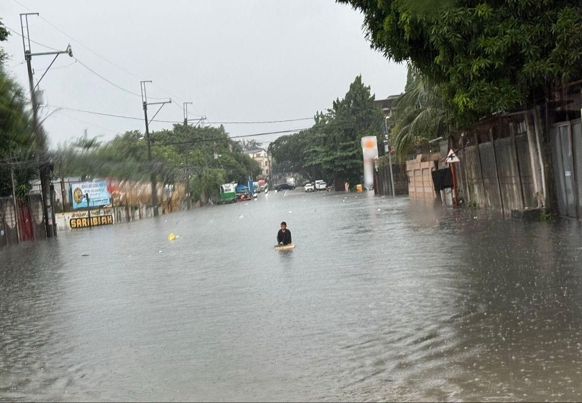
LIVE UPDATES: Habagat rains affect parts of PH on Sunday, Aug. 30, 2026
Marikina River under 2nd alarm as water goes down to 17 meters
Ni GMA News··9K nabasa
LIVE UPDATES: Habagat rains affect parts of PH on Sunday, Aug. 30, 2026
Marikina River under 2nd alarm as water goes down to 17 meters
The Marikina River was placed under second alarm early Sunday, August 30, as the water level slightly went down to 17 meters.
At 4:50 a.m., the water level at Marikina River was at 17.7 meters, down from 18.1 meters at 3:30 a.m., data from the Marikina City Public Information Office showed.
As of 5:25 a.m., the water level at the river was at 17.3 meters.
Continuous heavy rains from the Southwest Monsoon or Habagat caused the water to rise at Marikina River on Saturday until early Sunday.
Under Marikina City's alert system, the first alarm is raised when the water level reaches 15 meters above sea level, prompting affected residents to prepare for possible evacuation.
The second alarm is hoisted at 16 meters, prompting preemptive evacuation, while the third alarm is raised at 18 meters, signaling mandatory evacuation.
At 11:35 p.m. of Saturday, third alarm was raised after the water reached 18.4 meters. —Vince Angelo Ferreras/KG, GMA News
RAINFALL ALERT: Red warning up over 4 areas, parts of Tarlac, Bulacan (Sunday, 5 a.m.)
The weather bureau PAGASA placed Zambales, Bataan, Pampanga, and parts of Tarlac and Bulacan under red rainfall warning early Sunday as the Southwest Monsoon (Habagat) continued to bring heavy rains.
In its 5 a.m. advisory, PAGASA raised red, orange, and yellow rainfall warnings over the following areas:
Red rainfall warning (Serious flooding in flood-prone areas)
Zambales
Bataan
Pampanga
Tarlac (Mayantoc, San Jose, Capas, Bamban, San Clemente)
Bulacan (Hagonoy, Paombong, Calumpit, Malolos, Plaridel, Pulilan, Baliuag)
Orange rainfall warning (Flooding is still threatening)
Tarlac (Concepcion, Anao, Tarlac City, Gerona, La Paz, Paniqui, Pura, Ramos, San Manuel, Victoria, Camiling, Moncada, Santa Ignacia)
Nueva Ecija (Nampicuan, Guimba, Licab, Zaragoza, San Antonio, Cabiao)
Bulacan (San Miguel, San Ildefonso, San Rafael, Bulakan, Bustos, Guiguinto, Pandi, Balagtas)
Yellow rainfall warning (Flooding in flood-prone areas)
Metro Manila
Rizal
Cavite
Nueva Ecija (Gapan, General Tinio, San Isidro, Aliaga, Bongabon, Cabanatuan, Cuyapo, Gabaldon, General Mamerto Natividad, Jaen, Laur, Llanera, Lupao, Palayan, Pantabangan, Peñaranda, Quezon, Rizal, San Jose, San Leonardo, Santa Rosa, Santo Domingo, Muñoz, Talavera, Talugtug)
Batangas (Nasugbu, Lian, Calatagan, Balayan, Tuy)
Bulacan (Doña Remedios Trinidad, Norzagaray, San Jose del Monte, Meycauayan, Santa Maria, Angat, Bocaue, Marilao, Obando)
Laguna (San Pedro, Biñan, Santa Rosa, Cabuyao, Calamba)
PAGASA said light to moderate rains affecting parts of Nueva Ecija, Batangas, Laguna and Quezon may persist within three hours and may affect nearby areas.
The weather bureau advised the public and concerned disaster risk reduction and management offices to monitor weather conditions and watch for the next rainfall warning, scheduled for 8 a.m. Sunday. — MCG, GMA News
Habagat to continue affecting Luzon, Visayas — PAGASA
The Southwest Monsoon, or Habagat, will continue to bring monsoon rains over parts of Luzon and the Visayas on Sunday, August 30, according to the Philippine Atmospheric, Geophysical and Astronomical Services Administration (PAGASA).
In its 4 a.m. public weather forecast, PAGASA said monsoon rains are expected in Ilocos Sur, Pangasinan, La Union, Benguet, Bataan, Zambales, Tarlac and Pampanga.
The weather bureau warned of possible flash floods and landslides in these areas due to heavy to very heavy rains.
Metro Manila, Ilocos Norte, the rest of the Cordillera Administrative Region, Nueva Vizcaya, Nueva Ecija, Bulacan, Rizal, Cavite, Laguna, Batangas and Occidental Mindoro may experience occasional rains, with possible flash floods and landslides due to moderate to heavy rains.
Meanwhile, the rest of Luzon, Western Visayas and the Negros Island Region may have cloudy skies with scattered rains and thunderstorms.
The rest of the Visayas may experience partly cloudy to cloudy skies with isolated rain showers or thunderstorms, while Mindanao may have partly cloudy to cloudy skies with isolated rain showers or thunderstorms due to localized thunderstorms.
PAGASA said severe thunderstorms in the Visayas and Mindanao could trigger flash floods or landslides.
A low-pressure area was also estimated 1,340 kilometers east of extreme Northern Luzon at 3 a.m. Sunday.
Meanwhile, Tropical Depression Saudel, formerly called "Obet," was outside the Philippine Area of Responsibility as of 3 a.m.
Saudel was located 1,105 kilometers west-northwest of extreme Northern Luzon, packing maximum sustained winds of 45 kph near the center and gusts of up to 75 kph.
It was moving southwestward at 25 kph.
PAGASA said moderate to strong winds from the southwest will prevail over Luzon, where coastal waters will be moderate to rough, with wave heights of 1.5 to 3.4 meters.
The rest of the country will experience light to moderate winds from the south to southwest, with slight to moderate coastal waters and wave heights of 0.6 to 2.1 meters.
Sunrise on Sunday, August 30, is at 5:44 a.m., while sunset is at 6:10 p.m. — MCG, GMA News
Flooding hits Bagong Silangan, Quezon City as Marikina River rises
Floodwaters have inundated parts of Barangay Bagong Silangan in Quezon City after the Marikina River was raised to the third alarm amid heavy rains.
According to a GMA News report by Gabriel Gonzalez, residents described the flooding in the area as less severe than in previous incidents.
The report early Sunday said muddy floodwaters had reached the Humanity area, prompting residents to use boats to navigate through flooded portions of the barangay.
Residents said an ongoing flood control project has supposedly helped mitigate flooding in the area, but its unfinished state means some communities remain vulnerable to rising waters.
The San Mateo River, which is connected to the Marikina River, was also overflowing, contributing to the flooding in the area.
Residents have evacuated to a designated evacuation center in Bagong Silangan, with nearly 3,000 individuals reportedly seeking shelter there as of early Sunday.
The flooding also left residents on edge, with many staying awake instead of their usual sleeping hours due to the rising waters. — MCG, GMA News
Marikina River placed under 3rd alarm as water level crosses 18 meters
Local authorities raised the third alarm for the Marikina River late Saturday night as continuous heavy rains due to the Southwest Monsoon (Habagat) pushed the water level beyond 18 meters.
At 11:35 p.m., the water level reached 18.4 meters, just over an hour after crossing the 18-meter mark (10:29 p.m.)
Under Marikina City's alert system, the first alarm is raised when the water level reaches 15 meters above sea level, prompting affected residents to prepare for possible evacuation.
The second alarm is triggered at 16 meters, prompting preemptive evacuation, while the third alarm is raised at 18 meters, signaling mandatory evacuation.
As the intensified southwest monsoon or Habagat rains batter Metro Manila and other parts of Luzon, several malls are offering free overnight parking, shelter, charging stations and Wi-Fi to affected residents.
2nd bridge in Tarlac City collapses amid Habagat rains
A second bridge in Tarlac City collapsed within a day as heavy rains from the Southwest Monsoon (Habagat) continued to batter the province, authorities said Saturday night.
The Agana Bridge in Barangay Tibag collapsed at around 8:32 p.m. on Saturday, August 29, according to a report from the Tarlac City Disaster Risk Reduction and Management Office.
Lubao residents lose homes to strong river currents
Several residents of Lubao, Pampanga, were forced to leave their homes after strong river currents eroded the riverbank and destroyed at least five houses.
In a report by John Consulta on “24 Oras Weekend” on Saturday, at least 107 people, or 30 families, had been relocated after their homes were destroyed.